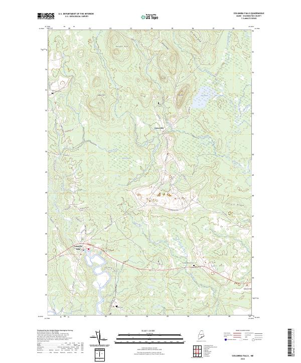
2024 Map of Columbia Falls
USGS Topo · Published 2024About this map
Columbia Falls sits at the head of tide on the Pleasant River, serving as a coastal anchor for this rural Washington County landscape. The town's historical geography is defined by its relationship with several branching waterways, including the Indian River and the Little River, which cut through a terrain of low hills like Sugar Hill and Patten Hill. These drainages historically supported local milling and agricultural activity, evidenced by labels like Brick Yard Rd near the riverbanks.
Find a feature on this map
54 named features on this map. Tap any name to fly to it.
Don’t see what you’re looking for? This feature index may not catch every label — zoom into the map to look around manually.
Map Details
Editions of this 2024 Columbia Falls Map
This is the sole edition of this map. No revisions or reprints were ever made.
Other maps of this area

1902 · Cherryfield
USGS Topo · 1:62,500

1904 · Cherryfield
USGS Topo · 1:62,500

1921 · Columbia Falls
USGS Topo · 1:62,500

1921 · Columbia Falls
USGS Topo · 1:62,500

1941 · Columbia Falls
USGS Topo · 1:62,500

1941 · Wesley
USGS Topo · 1:62,500

1941 · Tug Mountain
USGS Topo · 1:62,500

1942 · Cherryfield
USGS Topo · 1:62,500

1942 · Columbia Falls
USGS Topo · 1:62,500

1943 · Tug Mountain
USGS Topo · 1:62,500