
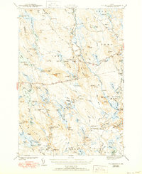
1943 Map of Tug Mountain
USGS Topo · Published 1943About this map
The Machias River and its West Branch anchor this 1941 survey of Washington County's interior. The landscape is defined by its industrial and recreational utility, marked by numerous logging or water-control structures such as Rolford Dam, Elwell Dam, and Canaan Dam. Settlement is largely transient or seasonal, characterized by a high concentration of named camps and lodges including Hartford Camp, Worcester Lodge, and Allison Worcester Camp.
Find a feature on this map
127 named features on this map. Tap any name to fly to it.
Don’t see what you’re looking for? This feature index may not catch every label — zoom into the map to look around manually.
Map Details
Editions of this 1943 Tug Mountain Map
2 editions found
Other maps of this area

1902 · Cherryfield
USGS Topo · 1:62,500

1904 · Cherryfield
USGS Topo · 1:62,500

1921 · Columbia Falls
USGS Topo · 1:62,500

1921 · Columbia Falls
USGS Topo · 1:62,500

1929 · Lead Mountain
USGS Topo · 1:48,000

1930 · Tunk Lake
USGS Topo · 1:48,000

1932 · Tunk Lake
USGS Topo · 1:62,500

1932 · Nicatous Lake
USGS Topo · 1:48,000

1932 · Lead Mountain
USGS Topo · 1:62,500

1934 · Nicatous Lake
USGS Topo · 1:62,500