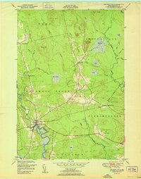
1951 Map of Columbia Falls
USGS Topo · Published 1951About this map
Columbia Falls serves as the focal point of this coastal Washington County landscape, where the Pleasant River winds through the lowlands before reaching the sea. The 1951 edition highlights the critical role of the Maine Central railroad, which links the inland Jonesboro Station to the regional commerce of the late 1940s. Moving north, the terrain transitions into the high ground of Milton Mtn and Patten Hill, overlooking a distinctive complex of peatlands including Big Heath and Marst Heath. These expansive heaths and intricate brook systems like Pecky Brook and Kaylor Brook illustrate the glacial heritage of the Down East region. The settlement pattern remains concentrated near the river crossings and rail lines, with smaller communities like Centerville and Central District providing evidence of the area's mid-century rural organization.
Find a feature on this map
38 named features on this map. Tap any name to fly to it.
Don’t see what you’re looking for? This feature index may not catch every label — zoom into the map to look around manually.
Map Details
Editions of this 1951 Columbia Falls Map
This is the sole edition of this map. No revisions or reprints were ever made.
Other maps of this area

1902 · Cherryfield
USGS Topo · 1:62,500

1904 · Cherryfield
USGS Topo · 1:62,500

1921 · Columbia Falls
USGS Topo · 1:62,500

1921 · Columbia Falls
USGS Topo · 1:62,500

1941 · Columbia Falls
USGS Topo · 1:62,500

1941 · Wesley
USGS Topo · 1:62,500

1941 · Tug Mountain
USGS Topo · 1:62,500

1942 · Cherryfield
USGS Topo · 1:62,500

1942 · Columbia Falls
USGS Topo · 1:62,500

1943 · Tug Mountain
USGS Topo · 1:62,500