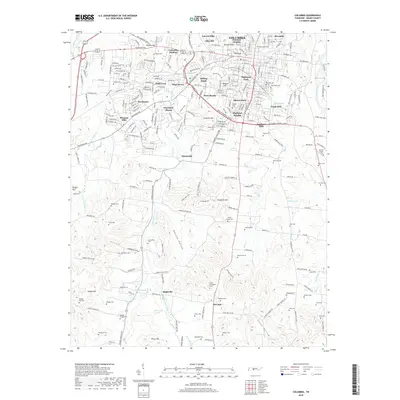
2019 Map of Columbia
USGS Topo · Published 2019About this map
The Duck River snakes through the northern reaches of Columbia, providing a natural backdrop for a landscape defined by its many historic neighborhoods and family burying grounds. This 2019 survey captures the residential density of communities like Highland Park, Riverside, and Westwood, while the southern terrain transitions into the agricultural valleys of Neeley Valley and Covey Hollow. Notable for its concentration of family-named landmarks, the area contains dozens of small cemeteries such as Zollicoffer Cem and Mount Evergreen Cem that offer a significant record of local genealogy. In the south, the settlements of Bigbyville and McCains anchor a rural landscape where streams like Little Bigby Creek and Lytle Cr carve through the limestone-rich topography. Prominent hills such as Rainey Hill and The Knob overlook the city, marking the varied elevation of this Maury County seat.
Find a feature on this map
89 named features on this map. Tap any name to fly to it.
Don’t see what you’re looking for? This feature index may not catch every label — zoom into the map to look around manually.
Map Details
Editions of this 2019 Columbia Map
This is the sole edition of this map. No revisions or reprints were ever made.
Other maps of this area

1901 · Colombia
USGS Topo · 1:125,000

1936 · Godwin
USGS Topo · 1:24,000

1936 · Sandy Hook
USGS Topo · 1:24,000

1936 · Williamsport
USGS Topo · 1:24,000

1936 · Campbells Station
USGS Topo · 1:24,000

1936 · Carters Creek
USGS Topo · 1:24,000

1936 · Mount Pleasant
USGS Topo · 1:24,000

1936 · Glendale
USGS Topo · 1:24,000

1936 · Columbia
USGS Topo · 1:24,000

1936 · Lynnville
USGS Topo · 1:24,000