2022 Map of Columbia
USGS Topo · Published 2022About this map
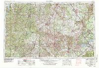
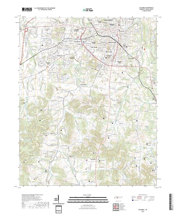
The Maury County Courthouse serves as the central landmark of Columbia, a city defined by its position along the Duck River and its radiating road networks. This modern survey illustrates the dense residential expansion surrounding the historic core, with neighborhoods like Riverside, Highland Heights, and Graymere Manor filling the landscape between the Columbia Byp and the interior streets. The map provides significant value for genealogical research, documenting numerous family and community burial sites such as Old City Cem, Zollicoffer Cem, and Patterson Cem.
Find a feature on this map
104 named features on this map. Tap any name to fly to it.
Don’t see what you’re looking for? This feature index may not catch every label — zoom into the map to look around manually.
Map Details
Editions of this 2022 Columbia Map
This is the sole edition of this map. No revisions or reprints were ever made.
Historical Maps of Idlewild Through Time
6 maps found