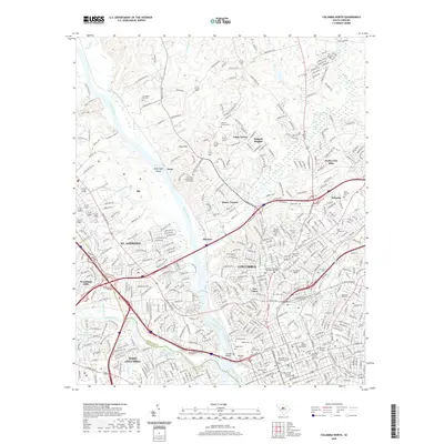
2020 Map of Columbia North
USGS Topo · Published 2020About this map
The confluence of the Broad River and Saluda River defines the geography of the state capital in this modern survey. As the two rivers merge to form the Congaree just south of this map, the historic Columbia Canal traces the eastern bank, passing the Timmerman Bridge. The landscape is a mix of dense urban development and academic institutions, including Allen University, Benedict College, and Columbia College. A significant concentration of historic burial grounds is visible, ranging from the Taylor Burying Ground and Hebrew Cem to the large Elmwood Cem.
Find a feature on this map
60 named features on this map. Tap any name to fly to it.
Don’t see what you’re looking for? This feature index may not catch every label — zoom into the map to look around manually.
Map Details
Editions of this 2020 Columbia North Map
This is the sole edition of this map. No revisions or reprints were ever made.
Other maps of this area

1904 · Columbia
USGS Topo · 1:125,000

1935 · Killian
USGS Topo · 1:48,000

1937 · Killian
USGS Topo · 1:62,500

1941 · Spartanburg
USGS Topo · 1:250,000

1942 · Camden
USGS Topo · 1:125,000

1944 · Edmund
USGS Topo · 1:62,500

1946 · Irmo
USGS Topo · 1:24,000

1947 · Columbia North
USGS Topo · 1:24,000

1947 · Richtex
USGS Topo · 1:24,000

1948 · Hopkins
USGS Topo · 1:62,500
Featured Places
- Columbia, SC
- West Columbia, SC
- Evergreen Park, SC
- Elmwood Park Historic District, Columbia
- Arlington Estates, SC