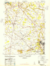
1948 Map of Columbus
USGS Topo · Published 1948About this map
Agricultural life and military expansion meet in Burlington County during the late 1940s. The village of Columbus serves as a central hub, while the surrounding landscape is defined by large specialized operations like the Helis Stock Farm and Walker Gordon Dairies. The southern portion of the map is dominated by the northern extent of the Fort Dix Military Reservation, showing the developed infrastructure of Fort Dix including the Tilton General Hospital.
Find a feature on this map
36 named features on this map. Tap any name to fly to it.
Don’t see what you’re looking for? This feature index may not catch every label — zoom into the map to look around manually.
Map Details
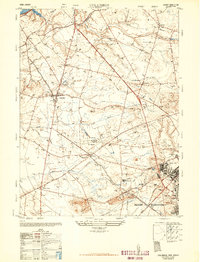
Editions of this 1948 Columbus Map
2 editions found
Other maps of this area

1888 · Bordentown
USGS Topo · 1:62,500

1888 · Pemberton
USGS Topo · 1:62,500

1888 · Mount Holly
USGS Topo · 1:62,500

1890 · Burlington
USGS Topo · 1:62,500

1893 · Bordentown
USGS Topo · 1:62,500

1893 · Burlington
USGS Topo · 1:62,500

1894 · Pemberton
USGS Topo · 1:62,500

1894 · Mount Holly
USGS Topo · 1:62,500

1898 · Pemberton
USGS Topo · 1:62,500

1898 · Mount Holly
USGS Topo · 1:62,500
Featured Places
- Bordentown Township, NJ
- Mansfield Township, NJ
- Chesterfield Township, NJ
- Eastampton Township, NJ
- Springfield Township, NJ