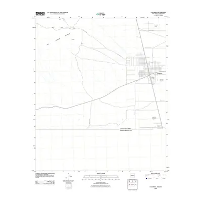
2010 Map of Columbus
USGS Topo · Published 2010About this map
The international border between the United States of America and Estados Unidos Mexicanos anchors this landscape, where the town of Columbus sits just north of the boundary line. The desert terrain is defined by the sharp rise of the Tres Hermanas Mountains to the west, featuring the Canon Mine and a local Quarry near Lindberg. Aviation history is prominent throughout the area, evidenced by the First Aero Squadron Airpark, Columbus Municipal Airport, and the Columbus Stockyards Airport. Infrastructure in this arid region is tied to water and transit, with the Rascon Windmill providing a vital point in Rascon Canyon while a network of county roads, including County Rd-C009 and County Rd-B063, connect the town to the surrounding high-desert ranching and mining lands.
Find a feature on this map
22 named features on this map. Tap any name to fly to it.
Don’t see what you’re looking for? This feature index may not catch every label — zoom into the map to look around manually.
Map Details
Editions of this 2010 Columbus Map
This is the sole edition of this map. No revisions or reprints were ever made.
Other maps of this area

1917 · Hermanas
USGS Topo · 1:62,500

1917 · Columbus
USGS Topo · 1:62,500

1918 · Columbus
USGS Topo · 1:62,500

1918 · Hermanas
USGS Topo · 1:62,500

1920 · Columbus
USGS Topo · 1:62,500

1943 · Hermanas
USGS Topo · 1:62,500

1953 · El Paso
USGS Topo · 1:250,000

1959 · El Paso
USGS Topo · 1:250,000

1964 · El Paso
USGS Topo · 1:250,000

1965 · El Paso
USGS Topo · 1:250,000