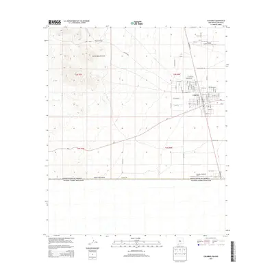
2013 Map of Columbus
USGS Topo · Published 2013About this map
The border town of Columbus serves as the focal point of this 2013 survey, situated where New Mexico meets the international boundary of the United States of America Estados Unidos Mexicanos. This desert landscape in Luna County is defined by its grid of residential streets and its significant aviation history, notably represented by the First Aero Squadron Airpark. Names like Pershing, Doolittle, and Roosevelt Ave reflect a deep military and political heritage tied to the town’s past. To the northwest, the terrain rises into the Tres Hermanas Mountains and the winding Rascon Canyon, while the southern edge of the village is marked by the Columbus Stockyards Airport near the border crossing. The map reveals a community organized around transit and legacy, from NM-9 to the named avenues like Grant Ave and Lincoln Ave that form the core of the settlement.
Find a feature on this map
65 named features on this map. Tap any name to fly to it.
Don’t see what you’re looking for? This feature index may not catch every label — zoom into the map to look around manually.
Map Details
Editions of this 2013 Columbus Map
This is the sole edition of this map. No revisions or reprints were ever made.
Other maps of this area

1917 · Hermanas
USGS Topo · 1:62,500

1917 · Columbus
USGS Topo · 1:62,500

1918 · Columbus
USGS Topo · 1:62,500

1918 · Hermanas
USGS Topo · 1:62,500

1920 · Columbus
USGS Topo · 1:62,500

1943 · Hermanas
USGS Topo · 1:62,500

1953 · El Paso
USGS Topo · 1:250,000

1959 · El Paso
USGS Topo · 1:250,000

1964 · El Paso
USGS Topo · 1:250,000

1965 · El Paso
USGS Topo · 1:250,000