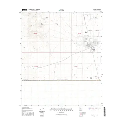
2017 Map of Columbus
USGS Topo · Published 2017About this map
The village of Columbus sits at the southern edge of New Mexico, just north of the United States of America Estados Unidos Mexicanos border. This desert landscape is shaped by historical aviation and transit, featuring the First Aero Squadron Airpark and the Columbus Stockyards Airport. The street grid of the village is clearly defined, with residential and commercial thoroughfares like Broadway and J Carreon St meeting at the town center.
Find a feature on this map
42 named features on this map. Tap any name to fly to it.
Don’t see what you’re looking for? This feature index may not catch every label — zoom into the map to look around manually.
Map Details
Editions of this 2017 Columbus Map
This is the sole edition of this map. No revisions or reprints were ever made.
Other maps of this area

1917 · Hermanas
USGS Topo · 1:62,500

1917 · Columbus
USGS Topo · 1:62,500

1918 · Columbus
USGS Topo · 1:62,500

1918 · Hermanas
USGS Topo · 1:62,500

1920 · Columbus
USGS Topo · 1:62,500

1943 · Hermanas
USGS Topo · 1:62,500

1953 · El Paso
USGS Topo · 1:250,000

1959 · El Paso
USGS Topo · 1:250,000

1964 · El Paso
USGS Topo · 1:250,000

1965 · El Paso
USGS Topo · 1:250,000