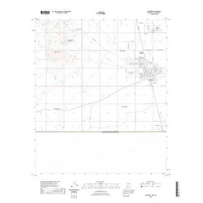
2020 Map of Columbus
USGS Topo · Published 2020About this map
The town of Columbus sits at a historic intersection of desert geography and international relations, positioned just north of the border between the United States of America and Estados Unidos Mexicanos. The landscape is dominated by the dry elevations of the Tres Hermanas Mountains to the northwest and the drainage of Rascon Canyon. To the north of the main settlement, the community known as the City of the Sun appears with its distinctive road layout including Sunshine Way and Rainbow Way. Local aviation history is preserved at the First Aero Squadron Airpark, complete with a mapped Windsock. The map detail captures the grid of Columbus, from Jas T Dean Blvd to the southern edge at Contento Ave, reflecting the modern layout of this significant border town.
Find a feature on this map
34 named features on this map. Tap any name to fly to it.
Don’t see what you’re looking for? This feature index may not catch every label — zoom into the map to look around manually.
Map Details
Editions of this 2020 Columbus Map
This is the sole edition of this map. No revisions or reprints were ever made.
Other maps of this area

1917 · Hermanas
USGS Topo · 1:62,500

1917 · Columbus
USGS Topo · 1:62,500

1918 · Columbus
USGS Topo · 1:62,500

1918 · Hermanas
USGS Topo · 1:62,500

1920 · Columbus
USGS Topo · 1:62,500

1943 · Hermanas
USGS Topo · 1:62,500

1953 · El Paso
USGS Topo · 1:250,000

1959 · El Paso
USGS Topo · 1:250,000

1964 · El Paso
USGS Topo · 1:250,000

1965 · El Paso
USGS Topo · 1:250,000