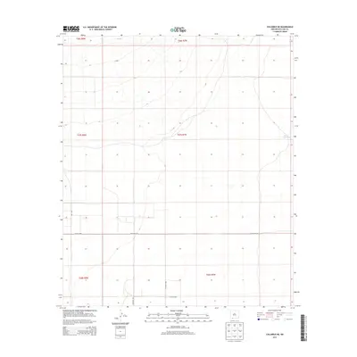
2013 Map of Columbus NE
USGS Topo · Published 2013About this map
The high desert basin of t27s r7w in Luna County is defined by its wide, open spaces and a grid of rural tracks that cross the arid landscape. While the region lacks dense settlement, the distribution of water sources like the Bueha Vista Tank and named thoroughfares such as Whirlwind Rd indicates a territory utilized for ranching and transport between more populated hubs. The map reveals the precise survey boundaries of the Public Land Survey System, including t26s r8w and t28s r8w, which organize the terrain into a predictable geometric structure. These desert roads, including Dustdevil Rd, serve as critical landmarks in an otherwise subtle topography, offering a clear view of the rural infrastructure in southwestern New Mexico during the early 21st century.
Find a feature on this map
11 named features on this map. Tap any name to fly to it.
Don’t see what you’re looking for? This feature index may not catch every label — zoom into the map to look around manually.
Map Details
Editions of this 2013 Columbus NE Map
This is the sole edition of this map. No revisions or reprints were ever made.
Other maps of this area

1899 · Deming
USGS Topo · 1:125,000

1915 · Deming
USGS Topo · 1:125,000

1917 · Camel Mountain
USGS Topo · 1:62,500

1917 · Columbus
USGS Topo · 1:62,500

1918 · Columbus
USGS Topo · 1:62,500

1920 · Columbus
USGS Topo · 1:62,500

1953 · El Paso
USGS Topo · 1:250,000

1955 · Las Cruces
USGS Topo · 1:250,000

1958 · Las Cruces
USGS Topo · 1:250,000

1959 · El Paso
USGS Topo · 1:250,000