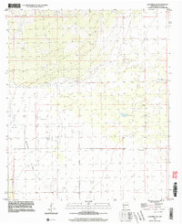
1996 Map of Columbus NE
USGS Topo · Published 2003About this map
The arid landscape of Luna County, New Mexico, is defined by an intricate network of water management features essential for ranching and survival in the high desert. Scattered across the terrain are numerous Well sites and livestock watering points like the Buena Vista Tank and Oney Tank, which mark the sparse human footprint in this corner of the Chihuahuan Desert. The topographic detail highlights the winding path of Seventysix Draw as it moves through the southern reaches of the quadrangle. Isolated landmarks such as the Coyote Windmill and Tucker Windmill serve as critical navigation points and evidence of the long-standing agricultural infrastructure in the region. Near the northern boundary, the presence of a Dry Lake underscores the ephemeral nature of water in this environment, where land use is dictated by seasonal shifts and the availability of groundwater.
Find a feature on this map
7 named features on this map. Tap any name to fly to it.
Don’t see what you’re looking for? This feature index may not catch every label — zoom into the map to look around manually.
Map Details
Editions of this 1996 Columbus NE Map
This is the sole edition of this map. No revisions or reprints were ever made.
Other maps of this area

1899 · Deming
USGS Topo · 1:125,000

1915 · Deming
USGS Topo · 1:125,000

1917 · Camel Mountain
USGS Topo · 1:62,500

1917 · Columbus
USGS Topo · 1:62,500

1918 · Columbus
USGS Topo · 1:62,500

1920 · Columbus
USGS Topo · 1:62,500

1953 · El Paso
USGS Topo · 1:250,000

1955 · Las Cruces
USGS Topo · 1:250,000

1958 · Las Cruces
USGS Topo · 1:250,000

1959 · El Paso
USGS Topo · 1:250,000