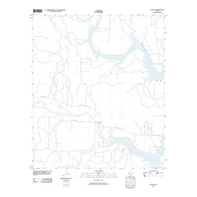
2010 Map of Concho
USGS Topo · Published 2010About this map
The confluence of the Concho River and the Colorado River defines this Central Texas landscape as it appeared in the early 21st century. The map centers on the small community of Concho, situated near the southern banks of the river before it meets the vast waters of the O. H. Ivie Reservoir. This reservoir dominates the eastern half of the quadrangle, drowning former river bends and creating prominent topographic features like Deadmans Bluff and Brushy Bluff along its winding shoreline.
Find a feature on this map
26 named features on this map. Tap any name to fly to it.
Don’t see what you’re looking for? This feature index may not catch every label — zoom into the map to look around manually.
Map Details
Editions of this 2010 Concho Map
This is the sole edition of this map. No revisions or reprints were ever made.
Other maps of this area

1892 · Eden
USGS Topo · 1:125,000

1892 · Ballinger
USGS Topo · 1:125,000

1896 · Eden
USGS Topo · 1:125,000

1921 · Spur Creek
USGS Topo · 1:31,680

1925 · Ballinger 3-d
USGS Topo · 1:48,000

1925 · Ballinger 4-c
USGS Topo · 1:48,000

1931 · Stacy
USGS Topo · 1:62,500

1932 · Voss
USGS Topo · 1:62,500

1932 · Paint Rock
USGS Topo · 1:62,500

1954 · Brownwood
USGS Topo · 1:250,000