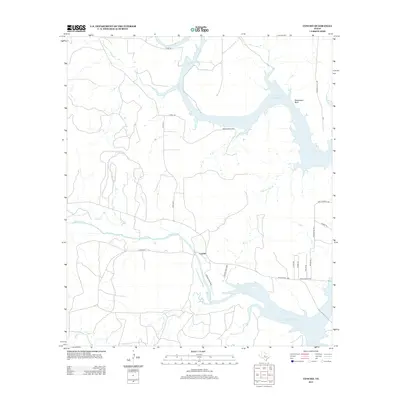
2013 Map of Concho
USGS Topo · Published 2013About this map
Concho River and Colorado River confluences are the defining geographic features of this Central Texas landscape, now largely dominated by the waters of the O. H. Ivie Reservoir. The settlement of Concho sits at the heart of a network of rural routes, including Ranch Road 1929 and numerous county and private roads that serve the ranching properties and lakeside developments. The topography is marked by distinct landmarks such as Deadmans Bluff overlooking the reservoir and various drainage branches like Dripping Hole Br and Fuzzy Cr. This modern survey illustrates how the impoundment of the rivers has transformed the local economy toward recreation and water management while maintaining the traditional grid of ranching access roads such as Co RD-4827 and Co RD-116.
Find a feature on this map
26 named features on this map. Tap any name to fly to it.
Don’t see what you’re looking for? This feature index may not catch every label — zoom into the map to look around manually.
Map Details
Editions of this 2013 Concho Map
This is the sole edition of this map. No revisions or reprints were ever made.
Other maps of this area

1892 · Eden
USGS Topo · 1:125,000

1892 · Ballinger
USGS Topo · 1:125,000

1896 · Eden
USGS Topo · 1:125,000

1921 · Spur Creek
USGS Topo · 1:31,680

1925 · Ballinger 3-d
USGS Topo · 1:48,000

1925 · Ballinger 4-c
USGS Topo · 1:48,000

1931 · Stacy
USGS Topo · 1:62,500

1932 · Voss
USGS Topo · 1:62,500

1932 · Paint Rock
USGS Topo · 1:62,500

1954 · Brownwood
USGS Topo · 1:250,000