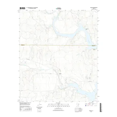
2016 Map of Concho
USGS Topo · Published 2016About this map
The confluence of the Colorado River and the Concho River dominates this landscape on the border of Runnels and Concho Counties. The small settlement of Concho sits south of the main river junction, connected by the Ray Stoker Jr Hwy. This 2016 survey illustrates a rugged Texan terrain marked by significant elevation changes at Deadmans Bluff and Brushy Bluff, where the rivers have carved deep into the limestone. Local landmarks such as Apache Hill and San Clemente provide distinct navigational points above the winding creek beds of Amos Creek and Dripping Hole Branch. The map captures a contemporary look at rural Texas ranching country, showing the network of county roads like Co Rd 115 and Co Rd 102 that navigate the ridges and valleys between the major waterways.
Find a feature on this map
26 named features on this map. Tap any name to fly to it.
Don’t see what you’re looking for? This feature index may not catch every label — zoom into the map to look around manually.
Map Details
Editions of this 2016 Concho Map
This is the sole edition of this map. No revisions or reprints were ever made.
Other maps of this area

1892 · Eden
USGS Topo · 1:125,000

1892 · Ballinger
USGS Topo · 1:125,000

1896 · Eden
USGS Topo · 1:125,000

1921 · Spur Creek
USGS Topo · 1:31,680

1925 · Ballinger 3-d
USGS Topo · 1:48,000

1925 · Ballinger 4-c
USGS Topo · 1:48,000

1931 · Stacy
USGS Topo · 1:62,500

1932 · Voss
USGS Topo · 1:62,500

1932 · Paint Rock
USGS Topo · 1:62,500

1954 · Brownwood
USGS Topo · 1:250,000