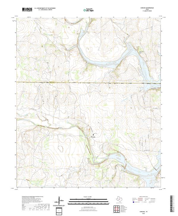
2022 Map of Concho
USGS Topo · Published 2022About this map
Colorado River and Concho River converge in this part of Central Texas, defining a landscape of sharp relief and deep-cut drainage. The settlement of Concho sits south of the main river fork, marked by the presence of Concho Cem. This area is characterized by dramatic elevation changes at the river's edge, most notably at Deadmans Bluff and Brushy Bluff in the eastern portion of the quadrangle.
Find a feature on this map
26 named features on this map. Tap any name to fly to it.
Don’t see what you’re looking for? This feature index may not catch every label — zoom into the map to look around manually.
Map Details
Editions of this 2022 Concho Map
This is the sole edition of this map. No revisions or reprints were ever made.
Other maps of this area

1892 · Eden
USGS Topo · 1:125,000

1892 · Ballinger
USGS Topo · 1:125,000

1896 · Eden
USGS Topo · 1:125,000

1921 · Spur Creek
USGS Topo · 1:31,680

1925 · Ballinger 3-d
USGS Topo · 1:48,000

1925 · Ballinger 4-c
USGS Topo · 1:48,000

1931 · Stacy
USGS Topo · 1:62,500

1932 · Voss
USGS Topo · 1:62,500

1932 · Paint Rock
USGS Topo · 1:62,500

1954 · Brownwood
USGS Topo · 1:250,000