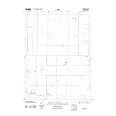
2011 Map of Concord
USGS Topo · Published 2011About this map
The agricultural landscape of Dixon County is defined by a grid of rural avenues and the winding paths of several creeks in the early 21st century. The village of Concord serves as a local hub, home to the Concord Post Office and the Dixon County Fairground. Just to the east, the University of Nebraska Experimental Station indicates the region's long-standing connection to agricultural research and development.
Find a feature on this map
32 named features on this map. Tap any name to fly to it.
Don’t see what you’re looking for? This feature index may not catch every label — zoom into the map to look around manually.
Map Details
Editions of this 2011 Concord Map
This is the sole edition of this map. No revisions or reprints were ever made.
Other maps of this area

1898 · Elk Point
USGS Topo · 1:125,000

1901 · Elk Point
USGS Topo · 1:125,000

1907 · Elk Point
USGS Topo · 1:125,000

1955 · Sioux City
USGS Topo · 1:250,000

1958 · Sioux City
USGS Topo · 1:250,000

1959 · Sioux City
USGS Topo · 1:250,000

1964 · Martinsburg SW
USGS Topo · 1:24,000
1964 · Martinsburg
USGS Topo · 1:24,000
1967 · Allen
USGS Topo · 1:24,000

1967 · Wakefield SW
USGS Topo · 1:24,000