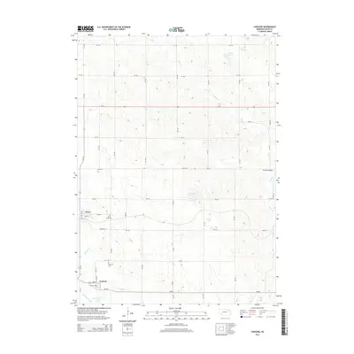
2014 Map of Concord
USGS Topo · Published 2014About this map
Concord and Dixon anchor this Dixon County landscape, which is defined by a grid of rural roads and a complex network of waterways. The drainage patterns are particularly noteworthy, showing the modification of the land through the Logan Cr Dredge alongside the winding Old Channel Logan Creek. This illustrates the transition from natural prairie drainage to managed agricultural water systems, further evidenced by man-made catchments like Blohm Reservoir and Fharenholtz Reservoir.
Find a feature on this map
39 named features on this map. Tap any name to fly to it.
Don’t see what you’re looking for? This feature index may not catch every label — zoom into the map to look around manually.
Map Details
Editions of this 2014 Concord Map
This is the sole edition of this map. No revisions or reprints were ever made.
Other maps of this area

1898 · Elk Point
USGS Topo · 1:125,000

1901 · Elk Point
USGS Topo · 1:125,000

1907 · Elk Point
USGS Topo · 1:125,000

1955 · Sioux City
USGS Topo · 1:250,000

1958 · Sioux City
USGS Topo · 1:250,000

1959 · Sioux City
USGS Topo · 1:250,000

1964 · Martinsburg SW
USGS Topo · 1:24,000
1964 · Martinsburg
USGS Topo · 1:24,000
1967 · Allen
USGS Topo · 1:24,000

1967 · Wakefield SW
USGS Topo · 1:24,000