2021 Map of Concord
USGS Topo · Published 2021About this map
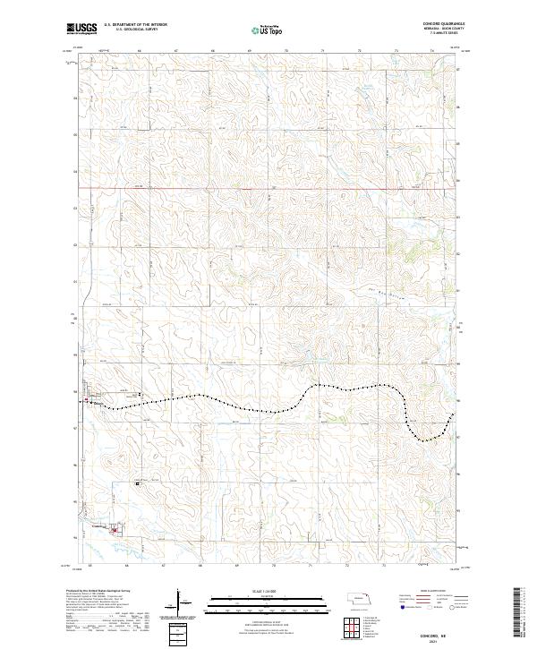
Concord and Dixon anchor this Dixon County landscape, positioned along the southern and western margins of the survey. The agricultural character of the region is defined by the complex water systems of N Logan Cr and the Old Channel Logan Creek, where human intervention is evident in the presence of the Logan Cr Dredge. In the northeastern quadrant, the terrain rises toward Tar Box Hollow and several managed water bodies, including Zekin Lake, Blohm Reservoir, and Flaxenholtz Reservoir. Genealogy researchers will find specific interest in the locations of Saint Annes Cem near Dixon and the Concord Cem just north of its namesake town. The township and range divisions, such as t29n r4e, provide a clear grid for tracking land ownership and historical property boundaries across this rural Nebraska corridor.
Find a feature on this map
44 named features on this map. Tap any name to fly to it.
Don’t see what you’re looking for? This feature index may not catch every label — zoom into the map to look around manually.
Map Details
Editions of this 2021 Concord Map
This is the sole edition of this map. No revisions or reprints were ever made.
Historical Maps of Dixon Through Time
Featured Locations
- Wakefield Township, NE
- Clark Township, NE
- Concord Township, NE
- Concord, Concord Township
- Dixon, Concord Township