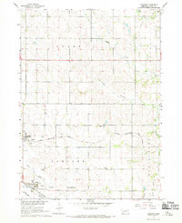
1967 Map of Concord
USGS Topo · Published 1969About this map
Dixon and Concord anchor this agricultural landscape in Northeast Nebraska during the late 1960s. The region is defined by a dense network of section-line roads and the paths of two major railroads: the Chicago Burlington and Quincy and the Chicago and North Western. Local life is centered around institutions like the County Fairground and the University of Nebraska Experimental Station, reflecting the area's deep ties to the farming economy.
Find a feature on this map
24 named features on this map. Tap any name to fly to it.
Don’t see what you’re looking for? This feature index may not catch every label — zoom into the map to look around manually.
Map Details
Editions of this 1967 Concord Map
This is the sole edition of this map. No revisions or reprints were ever made.
Other maps of this area

1898 · Elk Point
USGS Topo · 1:125,000

1901 · Elk Point
USGS Topo · 1:125,000

1907 · Elk Point
USGS Topo · 1:125,000

1955 · Sioux City
USGS Topo · 1:250,000

1958 · Sioux City
USGS Topo · 1:250,000

1959 · Sioux City
USGS Topo · 1:250,000

1964 · Martinsburg SW
USGS Topo · 1:24,000
1964 · Martinsburg
USGS Topo · 1:24,000
1967 · Allen
USGS Topo · 1:24,000

1967 · Wakefield SW
USGS Topo · 1:24,000