2021 Map of Concordia
USGS Topo · Published 2021About this map
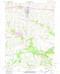
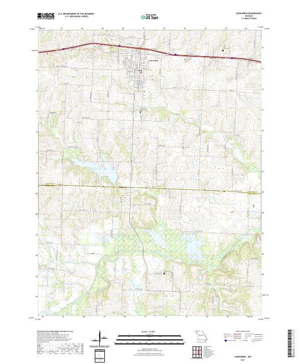
Concordia serves as the focal point of this western Missouri landscape, situated just north of the border between Lafayette and Johnson Counties. The town's grid is clearly defined by local thoroughfares such as S Main St and S Saint Louis St, leading south toward the Concordia Baptist Cemetery and Panther Creek. The surrounding agricultural lands are punctuated by water features including Edwin A Pape Lake and Horseshoe Lake, which feed into the extensive wetlands of the Blackwater River valley in the southern portion of the map. Genealogists may find value in the documentation of regional burial sites like Saint Johns Cemetery and Payne Cemetery, while the network of named roads like Hope Hill Rd and Zoar Rd illustrates the long-standing rural property divisions of the region.
Find a feature on this map
83 named features on this map. Tap any name to fly to it.
Don’t see what you’re looking for? This feature index may not catch every label — zoom into the map to look around manually.
Map Details
Editions of this 2021 Concordia Map
This is the sole edition of this map. No revisions or reprints were ever made.