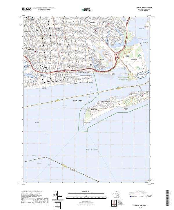
2023 Map of Coney Island
USGS Topo · Published 2023About this map
Coney Island and the southwestern shoreline of Brooklyn are depicted in high detail in this modern coastal survey. The map documents the dense urban grid of historical neighborhoods like Bensonhurst, Gravesend, and New Utrecht, punctuated by long-standing landmarks such as Washington Cem and Gravesend Cem. Significant educational and cultural institutions are noted throughout the residential blocks, including the Mirrer Yeshiva Central Institute and the Yeshiva Rabbi Chaim Berlin Academy, reflecting the area's deep community roots.
Find a feature on this map
65 named features on this map. Tap any name to fly to it.
Don’t see what you’re looking for? This feature index may not catch every label — zoom into the map to look around manually.
Map Details
Editions of this 2023 Coney Island Map
This is the sole edition of this map. No revisions or reprints were ever made.
Other maps of this area

1888 · Sandy Hook
USGS Topo · 1:62,500

1889 · Brooklyn
USGS Topo · 1:62,500

1891 · Brooklyn
USGS Topo · 1:62,500

1893 · Sandy Hook
USGS Topo · 1:62,500

1897 · Brooklyn
USGS Topo · 1:62,500

1898 · Staten Island
USGS Topo · 1:62,500

1898 · Brooklyn
USGS Topo · 1:62,500

1900 · Passaic
USGS Topo · 1:125,000

1900 · Staten Island
USGS Topo · 1:62,500

1900 · Brooklyn
USGS Topo · 1:62,500