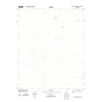
2012 Map of Confidence Hills West
USGS Topo · Published 2012About this map
Confidence Hills and the winding course of the Amargosa River dominate this arid landscape in San Bernardino County. This 2012 U.S. Geological Survey topographic study documents a region defined by dramatic natural drainage patterns, where seasonal runoff carved deep paths through the terrain. Evidence of these erosional forces is found in the prominent Talc Canyon, Owlshead Canyon, and Contact Canyon. The map illustrates how the Amargosa River cuts through the northeast corner, serving as a primary hydrological feature for this desert environment. Geologists and desert historians can use this survey to examine the distinct topographical boundaries between the hills and the canyon floors.
Find a feature on this map
5 named features on this map. Tap any name to fly to it.
Don’t see what you’re looking for? This feature index may not catch every label — zoom into the map to look around manually.
Map Details
Editions of this 2012 Confidence Hills West Map
This is the sole edition of this map. No revisions or reprints were ever made.
Other maps of this area

1933 · Avawatz Mountains
USGS Topo · 1:250,000

1947 · Trona
USGS Topo · 1:250,000

1948 · Trona
USGS Topo · 1:250,000

1948 · Quail Mountains
USGS Topo · 1:62,500

1948 · Leach Lake
USGS Topo · 1:62,500

1950 · Wingate Wash
USGS Topo · 1:62,500

1950 · Confidence Hills
USGS Topo · 1:62,500

1951 · Quail Mountains
USGS Topo · 1:62,500
1951 · Leach Lake
USGS Topo · 1:62,500

1953 · Trona
USGS Topo · 1:250,000