
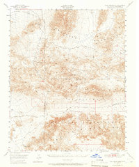
1948 Map of Quail Mountains
USGS Topo · Published 1957About this map
The Epsom Salts Works and the striking trace of an Abandoned Monorail dominate the northwestern reaches of this high-desert landscape in the late 1940s. This region is defined by the convergence of the Owlshead Mountains, Quail Mountains, and Granite Mountains, creating a complex network of ridgelines and deep basins. Human activity is largely dictated by water and defense, with the Camp Irwin Military Reservation covering a significant portion of the territory.
Find a feature on this map
18 named features on this map. Tap any name to fly to it.
Don’t see what you’re looking for? This feature index may not catch every label — zoom into the map to look around manually.
Map Details
Editions of this 1948 Quail Mountains Map
2 editions found
Other maps of this area

1915 · Searles Lake
USGS Topo · 1:250,000

1933 · Avawatz Mountains
USGS Topo · 1:250,000

1947 · Trona
USGS Topo · 1:250,000

1948 · Trona
USGS Topo · 1:250,000

1948 · Leach Lake
USGS Topo · 1:62,500

1948 · Goldstone Lake
USGS Topo · 1:62,500

1948 · Tiefort Mountains
USGS Topo · 1:62,500

1950 · Manly Peak
USGS Topo · 1:62,500

1950 · Wingate Wash
USGS Topo · 1:62,500

1950 · Confidence Hills
USGS Topo · 1:62,500