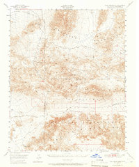
1948 Map of Quail Mountains
USGS Topo · Published 1966About this map
The Abandoned Monorail cutting across the northern reaches of this terrain serves as a fascinating marker of mid-century industrial experimentation in the California desert. Surveyed in 1948, this sheet documents the intersection of three major ranges: the Owlshead Mountains, Quatl Mountains, and Granite Mountains. The landscape is defined by its arid isolation, where life and travel are dictated by the location of remote water sources like Hidden Spring, Quail Spring, and Myrick Spring.
Find a feature on this map
15 named features on this map. Tap any name to fly to it.
Don’t see what you’re looking for? This feature index may not catch every label — zoom into the map to look around manually.
Map Details
Editions of this 1948 Quail Mountains Map
2 editions found
Other maps of this area

1915 · Searles Lake
USGS Topo · 1:250,000

1933 · Avawatz Mountains
USGS Topo · 1:250,000

1947 · Trona
USGS Topo · 1:250,000

1948 · Trona
USGS Topo · 1:250,000

1948 · Quail Mountains
USGS Topo · 1:62,500

1948 · Leach Lake
USGS Topo · 1:62,500

1948 · Goldstone Lake
USGS Topo · 1:62,500

1948 · Tiefort Mountains
USGS Topo · 1:62,500

1950 · Manly Peak
USGS Topo · 1:62,500

1950 · Wingate Wash
USGS Topo · 1:62,500