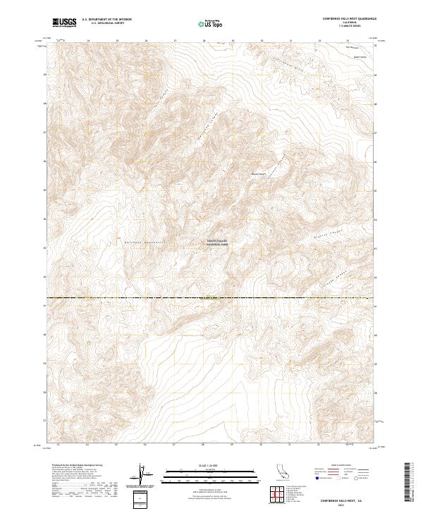
2021 Map of Confidence Hills West
USGS Topo · Published 2021About this map
The Owlshead Mountains dominate this high-desert landscape within the southern reaches of Death Valley National Park. The survey illustrates a terrain defined by complex drainage systems and canyon networks, including Talc Canyon, Owlshead Canyon, and Contact Canyon, which cut through the uplifted peaks toward the Mojave Desert. Along the northeastern corner, the Amargosa River passes through a constriction known as The Narrows, where the watercourse skirts the edge of the Confidence Hills. The boundary between Inyo and San Bernardino Counties bisects the region, marking a jurisdictional division in this remote stretch of southeastern California. This documentation highlights the intersection of massive alluvial fans and steep mountain fronts, providing a clear view of the natural corridors like Granite Canyon and Through Canyon that shaped early desert passage.
Find a feature on this map
17 named features on this map. Tap any name to fly to it.
Don’t see what you’re looking for? This feature index may not catch every label — zoom into the map to look around manually.
Map Details
Editions of this 2021 Confidence Hills West Map
This is the sole edition of this map. No revisions or reprints were ever made.
Other maps of this area

1933 · Avawatz Mountains
USGS Topo · 1:250,000

1947 · Trona
USGS Topo · 1:250,000

1948 · Trona
USGS Topo · 1:250,000

1948 · Quail Mountains
USGS Topo · 1:62,500

1948 · Leach Lake
USGS Topo · 1:62,500

1950 · Wingate Wash
USGS Topo · 1:62,500

1950 · Confidence Hills
USGS Topo · 1:62,500

1951 · Quail Mountains
USGS Topo · 1:62,500
1951 · Leach Lake
USGS Topo · 1:62,500

1953 · Trona
USGS Topo · 1:250,000