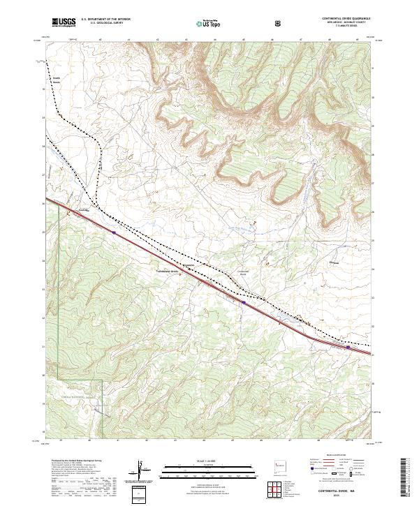
2023 Map of Continental Divide
USGS Topo · Published 2023About this map
The Continental Divide crests through this high-altitude landscape of McKinley County, serving as a primary geographical anchor for the surrounding high-desert settlements. The South Fork Puerco River winds through the northern sections, passing near the communities of Coolidge, Gonzales, and Thoreau. This modern survey reveals the persistent influence of the Atlantic and Pacific Railroad’s legacy on current infrastructure, where major transportation corridors like W Coolidge Rd and Frontage Rd parallel the historic rail path. To the south, the topography transitions into the protected lands of the Cibola National Forest, marked by steep drainages such as Whitewater Canyon and Foster Canyon. The map provides specific local details for land management and genealogy, from the remote North Guam area to the livestock-related infrastructure of Radar Tank and the seasonal waters of Gonzales Lake.
Find a feature on this map
30 named features on this map. Tap any name to fly to it.
Don’t see what you’re looking for? This feature index may not catch every label — zoom into the map to look around manually.
Map Details
Editions of this 2023 Continental Divide Map
This is the sole edition of this map. No revisions or reprints were ever made.
Other maps of this area

1886 · Wingate
USGS Topo · 1:250,000

1892 · Wingate
USGS Topo · 1:250,000

1954 · Gallup
USGS Topo · 1:250,000

1958 · Gallup
USGS Topo · 1:250,000

1959 · Gallup
USGS Topo · 1:250,000

1961 · Cottonwood Canyon
USGS Topo · 1:24,000

1962 · Gallup
USGS Topo · 1:250,000

1962 · Ciniza
USGS Topo · 1:24,000

1962 · Continental Divide
USGS Topo · 1:24,000

1962 · Cottonwood Canyon
USGS Topo · 1:24,000