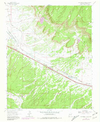
1962 Map of Continental Divide
USGS Topo · Published 1981About this map
The Continental Divide ridge line serves as the topographical backbone of this McKinley County landscape, where transportation and infrastructure follow the natural contours of the high plateau. The Atchison Topeka and Santa Fe railroad runs parallel to historic Route 66 and the newer Interstate 40, creating a vital transit corridor through the high desert. Along this route, small settlements and stopping points like Coolidge, Gonzales, and Continental Divide reflect the era's reliance on rail and highway commerce. A prominent Post Office and a Landing Strip near the railroad tracks underscore the area's role as a logistical hub. To the south, the terrain descends into Whitewater Canyon within the Cibola National Forest, while various industrial features like a Quarry and Sandpit indicate the local extraction of resources used to build the region's expanding infrastructure.
Find a feature on this map
22 named features on this map. Tap any name to fly to it.
Don’t see what you’re looking for? This feature index may not catch every label — zoom into the map to look around manually.
Map Details
Editions of this 1962 Continental Divide Map
2 editions found
Other maps of this area

1886 · Wingate
USGS Topo · 1:250,000

1892 · Wingate
USGS Topo · 1:250,000

1954 · Gallup
USGS Topo · 1:250,000

1958 · Gallup
USGS Topo · 1:250,000

1959 · Gallup
USGS Topo · 1:250,000

1961 · Cottonwood Canyon
USGS Topo · 1:24,000

1962 · Gallup
USGS Topo · 1:250,000

1962 · Ciniza
USGS Topo · 1:24,000

1962 · Continental Divide
USGS Topo · 1:24,000

1962 · Cottonwood Canyon
USGS Topo · 1:24,000