
1954 Map of Gallup
USGS Topo · Published 1973About this map
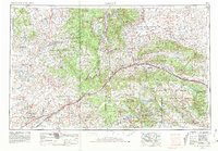
Gallup serves as the primary hub of this high-desert landscape, situated along the corridor of the Atchison Topeka and Santa Fe railroad and U S 66. This mid-century survey illustrates the intricate relationship between the tribal lands of the Navajo Indian Reservation and the Zuni Indian Reservation, and the administrative and historical sites that punctuate them. Significant cultural landmarks like the Hubbell Trading Post Nat Hist Site and El Morro Nat Mon are documented alongside vital water sources such as the Rio Puerco and Pescado Creek.
Find a feature on this map
86 named features on this map. Tap any name to fly to it.
Don’t see what you’re looking for? This feature index may not catch every label — zoom into the map to look around manually.
Map Details
Editions of this 1954 Gallup Map
2 editions found
Other maps of this area

1883 · Marsh Pass
USGS Topo · 1:250,000

1883 · Mt. Taylor
USGS Topo · 1:250,000

1883 · Tusayan
USGS Topo · 1:250,000

1886 · St Johns
USGS Topo · 1:250,000

1886 · Wingate
USGS Topo · 1:250,000

1886 · Mt. Taylor
USGS Topo · 1:250,000

1886 · Tusayan
USGS Topo · 1:250,000

1886 · Fort Defiance
USGS Topo · 1:250,000

1886 · Holbrook
USGS Topo · 1:250,000

1889 · Largo
USGS Topo · 1:250,000
Featured Places
- Gallup, NM
- Chinle Agency, AZ
- Fort Defiance Agency
- Fort Defiance, Fort Defiance Agency
- Window Rock, Fort Defiance Agency