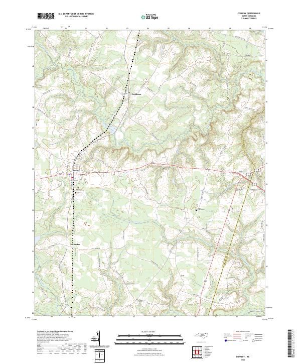
2022 Map of Conway
USGS Topo · Published 2022About this map
Conway and the surrounding agricultural lands of Northampton County are defined by a network of slow-moving waterways and wetland systems. The landscape is segmented by Panther Swamp and Potecasi Cr, which drain the low-lying terrain south of the main settlement. Small communities like Pendleton and Milwaukee are linked by a grid of rural roads, many bearing family names that reflect the area's long-standing land ownership and residential history. Near the eastern boundary with Hertford County, the Nebo Church Cem stands as a focal point for local genealogy and heritage.
Find a feature on this map
64 named features on this map. Tap any name to fly to it.
Don’t see what you’re looking for? This feature index may not catch every label — zoom into the map to look around manually.
Map Details
Editions of this 2022 Conway Map
This is the sole edition of this map. No revisions or reprints were ever made.
Other maps of this area

1919 · Boykins
USGS Topo · 1:48,000

1919 · Arringdale
USGS Topo · 1:48,000

1920 · Boykins
USGS Topo · 1:62,500

1920 · Arringdale
USGS Topo · 1:62,500

1942 · Arringdale
USGS Topo · 1:62,500

1953 · Norfolk
USGS Topo · 1:250,000

1966 · Margarettsville
USGS Topo · 1:24,000

1966 · Sunbeam
USGS Topo · 1:24,000
1966 · Boykins
USGS Topo · 1:24,000
1973 · Murfreesboro
USGS Topo · 1:24,000