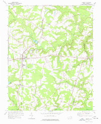
1973 Map of Conway
USGS Topo · Published 1977About this map
The agrarian landscape of Northampton and Hertford counties is defined here by the Seaboard Coast Line railroad and a network of blackwater drainages. Commercial life centers on Conway, Pendleton, and Milwaukee, where the rail corridor parallels the historic settlements and local industry, including Industrial Waste Ponds and a Sewage Disposal Pond that reflect mid-century infrastructure. The rural character is punctuated by numerous family and community cemeteries and historic congregations like Roberts Chapel and Bethany Ch.
Find a feature on this map
29 named features on this map. Tap any name to fly to it.
Don’t see what you’re looking for? This feature index may not catch every label — zoom into the map to look around manually.
Map Details
Editions of this 1973 Conway Map
This is the sole edition of this map. No revisions or reprints were ever made.
Other maps of this area

1919 · Boykins
USGS Topo · 1:48,000

1919 · Arringdale
USGS Topo · 1:48,000

1920 · Boykins
USGS Topo · 1:62,500

1920 · Arringdale
USGS Topo · 1:62,500

1942 · Arringdale
USGS Topo · 1:62,500

1953 · Norfolk
USGS Topo · 1:250,000

1966 · Margarettsville
USGS Topo · 1:24,000

1966 · Sunbeam
USGS Topo · 1:24,000
1966 · Boykins
USGS Topo · 1:24,000
1973 · Murfreesboro
USGS Topo · 1:24,000