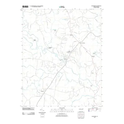
2010 Map of Cooleemee
USGS Topo · Published 2010About this map
South Yadkin River and its numerous tributaries, including Hunting Creek, Fourth Creek, and Third Creek, define the topography of this central North Carolina landscape. The historic importance of water power is evident at the Frohock Mill site and the Cooleemee Dam, while the rail influence is preserved at Cooleemee Junction. Small rural hubs such as Woodleaf, Jerusalem, and Davie Crossroads anchor the road network, connecting long-standing agricultural lands and community centers like Ephesus.
Find a feature on this map
68 named features on this map. Tap any name to fly to it.
Don’t see what you’re looking for? This feature index may not catch every label — zoom into the map to look around manually.
Map Details
Editions of this 2010 Cooleemee Map
This is the sole edition of this map. No revisions or reprints were ever made.
Other maps of this area

1893 · Statesville
USGS Topo · 1:125,000

1950 · Churchland
USGS Topo · 1:24,000

1951 · Churchland
USGS Topo · 1:24,000

1953 · Charlotte
USGS Topo · 1:250,000

1954 · Charlotte
USGS Topo · 1:250,000

1960 · Charlotte
USGS Topo · 1:250,000

1962 · Charlotte
USGS Topo · 1:250,000
1962 · Salisbury
USGS Topo · 1:24,000

1969 · Cooleemee
USGS Topo · 1:24,000

1969 · Cool Springs
USGS Topo · 1:24,000