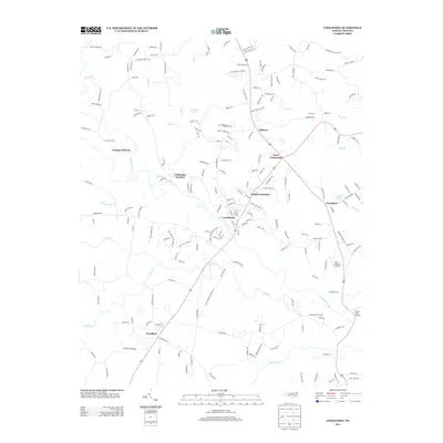
2013 Map of Cooleemee
USGS Topo · Published 2013About this map
The S Yadkin River serves as the primary geographic corridor through this section of Davie and Rowan Counties, with the historic Frohock Mill site situated along the winding banks of Hunting Cr. This 2013 survey illustrates the established settlement patterns of several small Piedmont communities, including the industrial-linked Cooleemee and the nearby Cooleemee Junction, which mark the intersection of labor and transport.
Find a feature on this map
191 named features on this map. Tap any name to fly to it.
Don’t see what you’re looking for? This feature index may not catch every label — zoom into the map to look around manually.
Map Details
Editions of this 2013 Cooleemee Map
This is the sole edition of this map. No revisions or reprints were ever made.
Other maps of this area

1893 · Statesville
USGS Topo · 1:125,000

1950 · Churchland
USGS Topo · 1:24,000

1951 · Churchland
USGS Topo · 1:24,000

1953 · Charlotte
USGS Topo · 1:250,000

1954 · Charlotte
USGS Topo · 1:250,000

1960 · Charlotte
USGS Topo · 1:250,000

1962 · Charlotte
USGS Topo · 1:250,000
1962 · Salisbury
USGS Topo · 1:24,000

1969 · Cooleemee
USGS Topo · 1:24,000

1969 · Cool Springs
USGS Topo · 1:24,000