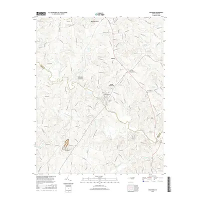
2016 Map of Cooleemee
USGS Topo · Published 2016About this map
Mocksville and the surrounding rural landscapes of the Davie Co Rowan Co line are defined by the winding course of the South Yadkin River. This modern topographic study reveals a transition from the structured residential blocks of Cooleemee and North Cooleemee to the agrarian stretches of Jerusalem and Woodleaf. Water resources are central to the region's geography, with the Burlington Mills Lake and Daniels Lake punctuating the drainage basins of Hunting Creek and Second Creek. The area maintains its transport-oriented character, featuring both the Tara Airbase and South River Airport. Local industry and rural infrastructure are evident through landmarks like the Quarry near Woodleaf and the intersection at Davie Crossroads, while family-named roads like Will Boone Rd and Towery Rd provide a clear view of the county's contemporary property and settlement patterns.
Find a feature on this map
141 named features on this map. Tap any name to fly to it.
Don’t see what you’re looking for? This feature index may not catch every label — zoom into the map to look around manually.
Map Details
Editions of this 2016 Cooleemee Map
This is the sole edition of this map. No revisions or reprints were ever made.
Other maps of this area

1893 · Statesville
USGS Topo · 1:125,000

1950 · Churchland
USGS Topo · 1:24,000

1951 · Churchland
USGS Topo · 1:24,000

1953 · Charlotte
USGS Topo · 1:250,000

1954 · Charlotte
USGS Topo · 1:250,000

1960 · Charlotte
USGS Topo · 1:250,000

1962 · Charlotte
USGS Topo · 1:250,000
1962 · Salisbury
USGS Topo · 1:24,000

1969 · Cooleemee
USGS Topo · 1:24,000

1969 · Cool Springs
USGS Topo · 1:24,000