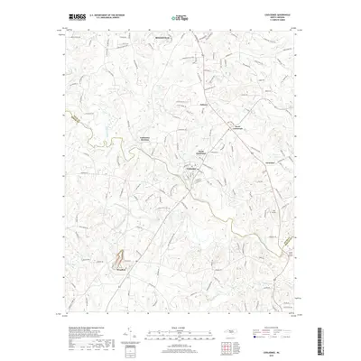
2019 Map of Cooleemee
USGS Topo · Published 2019About this map
Mocksville and the industrial corridor of the South Yadkin River anchor this late 2010s survey of the Davie and Rowan county line. The landscape is defined by the convergence of several major tributaries, including Hunting Creek, Second Creek, and Third Creek, which historically dictated the placement of early settlements. The town of Cooleemee and its neighbor North Cooleemee represent a concentration of residential and industrial development, while the proximity of Cooleemee Junction highlights the importance of rail-to-river connectivity in the region's growth.
Find a feature on this map
146 named features on this map. Tap any name to fly to it.
Don’t see what you’re looking for? This feature index may not catch every label — zoom into the map to look around manually.
Map Details
Editions of this 2019 Cooleemee Map
This is the sole edition of this map. No revisions or reprints were ever made.
Other maps of this area

1893 · Statesville
USGS Topo · 1:125,000

1950 · Churchland
USGS Topo · 1:24,000

1951 · Churchland
USGS Topo · 1:24,000

1953 · Charlotte
USGS Topo · 1:250,000

1954 · Charlotte
USGS Topo · 1:250,000

1960 · Charlotte
USGS Topo · 1:250,000

1962 · Charlotte
USGS Topo · 1:250,000
1962 · Salisbury
USGS Topo · 1:24,000

1969 · Cooleemee
USGS Topo · 1:24,000

1969 · Cool Springs
USGS Topo · 1:24,000