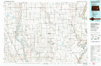
1985 Map of Cooperstown
USGS Topo · Published 1992About this map
The Arrowwood National Wildlife Refuge dominates the western landscape of this mid-1980s North Dakota survey, where the James River expands into a chain of lakes including Arrowwood Lake, Jim Lake, and Mud Lake. This water-rich corridor contrasts with the high, dry plains of the Rolling Prairie and the grain-hauling rail network connecting small agricultural hubs. Notable settlements like Cooperstown, Kensal, and Wimbledon are depicted alongside smaller sidings such as Millers Spur and Shepard. The eastern edge is defined by the winding Sheyenne River and the northern reaches of Lake Ashtabula, a massive reservoir complex. Wildlife management is a primary land use here, evidenced by the Ray Holland Marsh State Wildlife Area and the Tomahawk National Wildlife Refuge, which protect the critical prairie pothole habitat that characterizes the region's ecology and hydrology.
Find a feature on this map
108 named features on this map. Tap any name to fly to it.
Don’t see what you’re looking for? This feature index may not catch every label — zoom into the map to look around manually.
Map Details
Editions of this 1985 Cooperstown Map
2 editions found
Other maps of this area

1896 · Jamestown
USGS Topo · 1:125,000

1897 · Tower
USGS Topo · 1:125,000

1897 · Eckelson
USGS Topo · 1:125,000

1900 · Pingree
USGS Topo · 1:125,000

1900 · Pingree
USGS Topo · 1:62,500

1944 · Brantford
USGS Topo · 1:62,500

1946 · Brantford
USGS Topo · 1:62,500

1948 · New Rockford
USGS Topo · 1:62,500

1948 · Carrington
USGS Topo · 1:62,500

1949 · Grace City
USGS Topo · 1:24,000