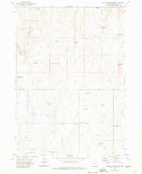
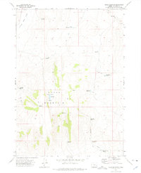
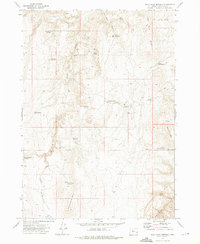
1972 Map of Copeland Reservoirs
USGS Topo · Published 1975About this map
Copeland Place stands as a primary human identifier in this high-desert landscape of southeastern Oregon, where water management is the central theme of the terrain. The 1970s survey reveals a complex network of catchment systems, including the namesake Copeland Reservoirs, East Copeland Res, and Antelope Flat Reservoir No 1, essential for supporting livestock and land use in this arid region. The geography is defined by high plateaus like Antelope Flat and the drainage of Wildcat Creek, which cuts through the volcanic geology of Copeland Butte. Geologists and historians can trace evidence of early mineral exploration at several prospects in the northern hills, while cattlemen relied on scattered infrastructure such as the Mc Kay Well and Slayton Well to sustain operations across the vast Butte country.
Find a feature on this map
29 named features on this map. Tap any name to fly to it.
Don’t see what you’re looking for? This feature index may not catch every label — zoom into the map to look around manually.
Map Details
Editions of this 1972 Copeland Reservoirs Map
This is the sole edition of this map. No revisions or reprints were ever made.
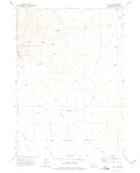
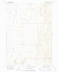
Other maps of this area

1955 · Boise
USGS Topo · 1:250,000

1958 · Boise
USGS Topo · 1:250,000

1962 · Boise
USGS Topo · 1:250,000
1972 · Cedar Mountain
USGS Topo · 1:24,000
1972 · Burnt Flat
USGS Topo · 1:24,000
1972 · Big Mud Flat
USGS Topo · 1:24,000
1972 · Wall Rock Springs
USGS Topo · 1:24,000
1972 · Alder Creek
USGS Topo · 1:24,000
1972 · Rufino Butte
USGS Topo · 1:24,000
1972 · Hurley Flat
USGS Topo · 1:24,000