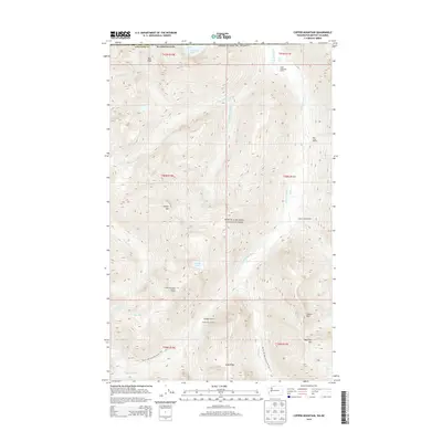
2014 Map of Copper Mountain
USGS Topo · Published 2014About this map
North Cascades National Park dominates this high-altitude landscape where the Chilliwack River and Little Chilliwack River carve through the northernmost reaches of the American border. This 2014 survey documents a network of remote infrastructure essential for wilderness navigation, including the Copper Mountain Lookout Tower and a series of backcountry refuges such as the Little Chilliwack Shelter and Greyball Shelter. The terrain is characterized by sharp elevation changes, from the heights of Copper Mtn and Mid Peak down to the basins of Hanging Lake and Egg Lake. The Pacific NW National Scenic Trail winds through the southern half of the quadrangle, crossing Easy Ridge and providing a primary corridor through this roadless territory. The presence of the United States Cabin near the southern border reflects the historic and ongoing management of this international frontier region.
Find a feature on this map
34 named features on this map. Tap any name to fly to it.
Don’t see what you’re looking for? This feature index may not catch every label — zoom into the map to look around manually.
Map Details
Editions of this 2014 Copper Mountain Map
This is the sole edition of this map. No revisions or reprints were ever made.
Other maps of this area

1909 · Mt Baker
USGS Topo · 1:192,000

1915 · Mt. Baker
USGS Topo · 1:250,000

1953 · Mt Shuksan
USGS Topo · 1:62,500

1953 · Mt Challenger
USGS Topo · 1:62,500

1955 · Concrete
USGS Topo · 1:250,000

1958 · Concrete
USGS Topo · 1:250,000

1962 · Concrete
USGS Topo · 1:250,000

1979 · Mt. Baker
USGS Topo · 1:100,000
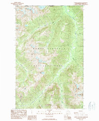
1989 · Copper Mountain
USGS Topo · 1:24,000
1989 · Mount Blum
USGS Topo · 1:24,000