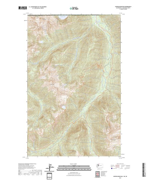
2023 Map of Copper Mountain
USGS Topo · Published 2023About this map
North Cascades National Park dominates this high-altitude landscape, where deep glaciated valleys are carved by the Chilliwack River and its numerous tributaries. The map documents a sophisticated network of backcountry infrastructure, centered on the Pacific Northwest National Scenic Trail and the Copper Ridge Trail. These routes connect remote alpine destinations such as Egg Lake Camp and the steep slopes of Copper Mountain. The topography is defined by sharp elevation changes, from the river bottoms to peaks like Red Face Mtn and Indian Mountain. This cartographic record is particularly valuable for its detail of high-elevation water bodies, including the isolated Hanging Lake near the international border and Copper Lake, illustrating the complex drainage patterns of Easy Ridge and the Stephen Mather Wilderness.
Find a feature on this map
37 named features on this map. Tap any name to fly to it.
Don’t see what you’re looking for? This feature index may not catch every label — zoom into the map to look around manually.
Map Details
Editions of this 2023 Copper Mountain Map
This is the sole edition of this map. No revisions or reprints were ever made.
Other maps of this area

1909 · Mt Baker
USGS Topo · 1:192,000

1915 · Mt. Baker
USGS Topo · 1:250,000

1953 · Mt Shuksan
USGS Topo · 1:62,500

1953 · Mt Challenger
USGS Topo · 1:62,500

1955 · Concrete
USGS Topo · 1:250,000

1958 · Concrete
USGS Topo · 1:250,000

1962 · Concrete
USGS Topo · 1:250,000

1979 · Mt. Baker
USGS Topo · 1:100,000
1989 · Copper Mountain
USGS Topo · 1:24,000
1989 · Mount Blum
USGS Topo · 1:24,000