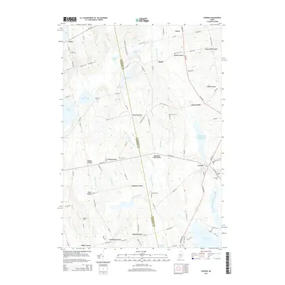
2014 Map of Corinna
USGS Topo · Published 2014About this map
Corinna serves as the primary hub for this central Maine landscape, situated where the East Branch Sebasticook River flows into the northern reaches of Sebasticook Lake. The surrounding countryside is defined by a dense network of namesake corners and small settlements, including Lincoln Mills, Lyford Corner, and Ripley, suggesting a long-established rural community built around small-scale industry and agriculture. Genealogists will find a wealth of burial records across the terrain, with sites such as Fern Dale Cem, Crocker Cem, and the Village Cem in Corinna itself. The boundary between Penobscot and Somerset counties bisects the map, running through various ponds like Weymouth Pond and Halfmoon Pond. Numerous brooks and streams, such as Mulligan Stream and Harrison White Brook, drain the wooded hills, feeding the various reservoirs and lakes that dominate the southern and northern boundaries of the quadrangle.
Find a feature on this map
107 named features on this map. Tap any name to fly to it.
Don’t see what you’re looking for? This feature index may not catch every label — zoom into the map to look around manually.
Map Details
Editions of this 2014 Corinna Map
This is the sole edition of this map. No revisions or reprints were ever made.
Other maps of this area

1930 · Pittsfield
USGS Topo · 1:48,000

1931 · Stetson
USGS Topo · 1:48,000

1932 · Dover-Foxcroft
USGS Topo · 1:48,000

1932 · Pittsfield
USGS Topo · 1:62,500

1933 · Pittsfield
USGS Topo · 1:62,500

1933 · Guilford
USGS Topo · 1:62,500

1935 · Dover-Foxcroft
USGS Topo · 1:62,500

1935 · Stetson
USGS Topo · 1:62,500

1937 · Guilford
USGS Topo · 1:62,500

1948 · Bangor
USGS Topo · 1:250,000