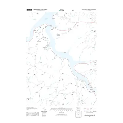
2013 Map of Cornplanter Bridge
USGS Topo · Published 2013About this map
Allegheny Reservoir dominates the landscape, its sinuous fingers reaching deep into the drainage basins of Jakes Run and Morrison Run. This modern topographic study reveals a topography shaped by recreation and forestry, where the Cornplanter Bridge provides a primary crossing for the Long House Scenic Dr. The settlement pattern is sparse, concentrated at Kinzua Heights and the small enclave at Swede Hill. High points like Coal Knob remain critical for fire surveillance via the Coal Knob Lookout Tower, while the rugged shoreline is dotted with public access points including Kinzua Beach and Dewdrop Campground. The map traces an extensive network of forestry roads such as Old State Rd and Mud Lick Rd, which navigate the steep terrain between prominent landmarks like Jakes Rocks and Rimrock Overlook.
Find a feature on this map
58 named features on this map. Tap any name to fly to it.
Don’t see what you’re looking for? This feature index may not catch every label — zoom into the map to look around manually.
Map Details
Editions of this 2013 Cornplanter Bridge Map
This is the sole edition of this map. No revisions or reprints were ever made.
Other maps of this area

1906 · Warren
USGS Topo · 1:62,500

1907 · Warren
USGS Topo · 1:62,500

1908 · Warren
USGS Topo · 1:62,500

1934 · Kane
USGS Topo · 1:48,000

1935 · Sheffield
USGS Topo · 1:48,000

1936 · Kinzua
USGS Topo · 1:48,000

1939 · Kane
USGS Topo · 1:62,500

1941 · Sheffield
USGS Topo · 1:62,500

1941 · Kinzua
USGS Topo · 1:62,500
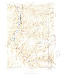
1949 · Kinzua
USGS Topo · 1:62,500
Featured Places
- Sheffield Township, PA
- Corydon Township, PA
- Glade Township, PA
- Elijah, Hamilton Township
- Mead Township, PA