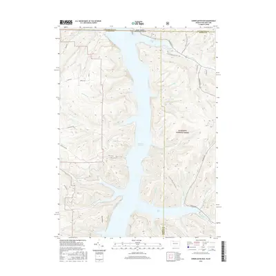
2016 Map of Cornplanter Run
USGS Topo · Published 2016About this map
The Allegheny Reservoir dominates this borderland landscape where New York and Pennsylvania meet. Much of the terrain is managed as part of the Allegheny National Forest, characterized by steep ridges and deep drainages like Roper Hollow and Schoolhouse Hollow. The historical footprint of the area is preserved at the Riverview Corydon Cem near Willow Bay, a reminder of the communities that existed before the valley was flooded. A network of stream systems, including Cornplanter Run, Hodge Run, and Johnnycake Run, carve through the uplands to reach the reservoir's eastern and western shores. For hikers and outdoor historians, the N Country National Scenic Trail winds through the eastern hills, following the high ground above Sugar Bay.
Find a feature on this map
47 named features on this map. Tap any name to fly to it.
Don’t see what you’re looking for? This feature index may not catch every label — zoom into the map to look around manually.
Map Details
Editions of this 2016 Cornplanter Run Map
This is the sole edition of this map. No revisions or reprints were ever made.
Other maps of this area

1905 · Jamestown
USGS Topo · 1:62,500

1906 · Warren
USGS Topo · 1:62,500

1907 · Warren
USGS Topo · 1:62,500

1908 · Warren
USGS Topo · 1:62,500

1922 · Randolph
USGS Topo · 1:62,500

1923 · Randolph
USGS Topo · 1:62,500

1936 · Kinzua
USGS Topo · 1:48,000

1941 · Kinzua
USGS Topo · 1:62,500

1942 · Jamestown
USGS Topo · 1:62,500

1943 · Randolph
USGS Topo · 1:62,500