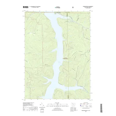
2019 Map of Cornplanter Run
USGS Topo · Published 2019About this map
The Allegheny Reservoir dominates this landscape along the border of New York and Pennsylvania, illustrating the modern geography of the Kinzua Dam's impact on the Allegheny River valley. Within the Allegheny National Forest, the map details an extensive network of recreational paths including the North Country National Scenic Trail and numerous loops for Tracy Ridge Hiking. Historical traces remain at the Riverview Corydon Cemetery, situated near the state line, serving as a reminder of the communities relocated or inundated by the reservoir project.
Find a feature on this map
51 named features on this map. Tap any name to fly to it.
Don’t see what you’re looking for? This feature index may not catch every label — zoom into the map to look around manually.
Map Details
Editions of this 2019 Cornplanter Run Map
This is the sole edition of this map. No revisions or reprints were ever made.
Other maps of this area

1905 · Jamestown
USGS Topo · 1:62,500

1906 · Warren
USGS Topo · 1:62,500

1907 · Warren
USGS Topo · 1:62,500

1908 · Warren
USGS Topo · 1:62,500

1922 · Randolph
USGS Topo · 1:62,500

1923 · Randolph
USGS Topo · 1:62,500

1936 · Kinzua
USGS Topo · 1:48,000

1941 · Kinzua
USGS Topo · 1:62,500

1942 · Jamestown
USGS Topo · 1:62,500

1943 · Randolph
USGS Topo · 1:62,500