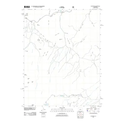
2011 Map of Cotopaxi
USGS Topo · Published 2011About this map
Arkansas River flows through the northern reaches of this region, carving the Arkansas River Canyon near the settlement of Cotopaxi. The landscape is defined by its industrial history, specifically mining, with several operations scattered across the high country. To the west near Coaldale and Pleasanton, researchers can identify the Jones and Young Lease Mine, while further south and east, the Lightning Number Two Mine, Blue Spar Mine, and the Perry de Lellis Claim mark the ground. These extraction sites are linked by a network of drainage gulches and forest roads like County Rd 1A. To the south, the terrain rises toward Wulsten Baldy, where recreational markers like the Rainbow Trail and Lake Creek Campground near Balman Reservoir signal a shift from industry to conservation and land management.
Find a feature on this map
63 named features on this map. Tap any name to fly to it.
Don’t see what you’re looking for? This feature index may not catch every label — zoom into the map to look around manually.
Map Details
Editions of this 2011 Cotopaxi Map
This is the sole edition of this map. No revisions or reprints were ever made.
Other maps of this area

1950 · Valley View Hot Springs
USGS Topo · 1:24,000

1954 · Pueblo
USGS Topo · 1:250,000

1957 · Pueblo
USGS Topo · 1:250,000

1958 · Pueblo
USGS Topo · 1:250,000

1958 · Beckwith Mountain
USGS Topo · 1:24,000

1959 · Electric Peak
USGS Topo · 1:62,500

1959 · Howard
USGS Topo · 1:62,500

1959 · Cotopaxi
USGS Topo · 1:62,500

1962 · Pueblo
USGS Topo · 1:250,000

1966 · Pueblo
USGS Topo · 1:250,000