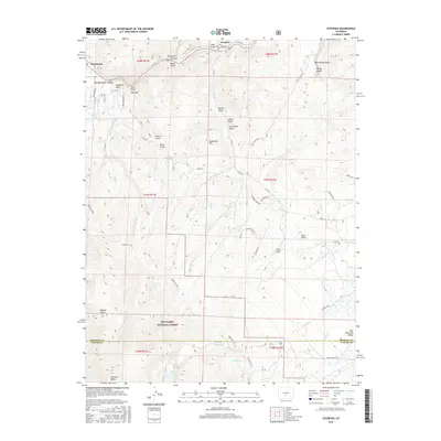
2016 Map of Cotopaxi
USGS Topo · Published 2016About this map
The Arkansas River carves through the north of this quadrangle, creating the steep Arkansas River Canyon near the community of Cotopaxi. This high-altitude landscape is defined by its dramatic relief, spanning from the river valley up to the peaks of the San Isabel National Forest, including the prominent Wulsten Baldy. The map reveals a network of drainage systems and gulches with evocative names like Deadmans Hill, Iron Dollar Gulch, and Mine Gulch, which suggest the area's prospecting and ranching heritage. Long-distance recreation is represented by the Rainbow Trail, which skirts the eastern edges of the forest. In the south, the terrain transitions toward the northern reach of the Wet Mountain Valley, where high-elevation water features like Rainbow Lake and the Balman Reservoir anchor the mountain hydrology.
Find a feature on this map
62 named features on this map. Tap any name to fly to it.
Don’t see what you’re looking for? This feature index may not catch every label — zoom into the map to look around manually.
Map Details
Editions of this 2016 Cotopaxi Map
This is the sole edition of this map. No revisions or reprints were ever made.
Other maps of this area

1950 · Valley View Hot Springs
USGS Topo · 1:24,000

1954 · Pueblo
USGS Topo · 1:250,000

1957 · Pueblo
USGS Topo · 1:250,000

1958 · Pueblo
USGS Topo · 1:250,000

1958 · Beckwith Mountain
USGS Topo · 1:24,000

1959 · Electric Peak
USGS Topo · 1:62,500

1959 · Howard
USGS Topo · 1:62,500

1959 · Cotopaxi
USGS Topo · 1:62,500

1962 · Pueblo
USGS Topo · 1:250,000

1966 · Pueblo
USGS Topo · 1:250,000