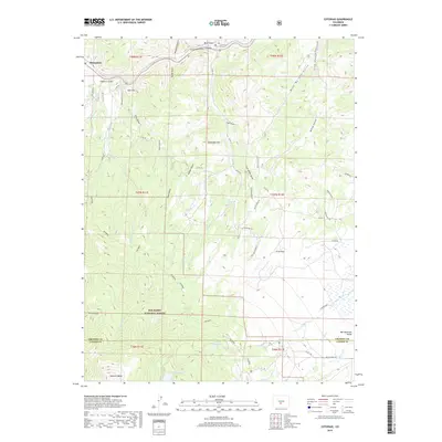
2019 Map of Cotopaxi
USGS Topo · Published 2019About this map
The Arkansas River carves through the northern reaches of this landscape, defining the steep Arkansas River Canyon near the settlement of Pleasanton. This region of the San Isabel National Forest transition from river-carved gulches like Henthorn Gulch and Mine Gulch into the high-elevation terrain of the Wet Mountain Valley. Significant landmarks such as Wulsten Baldy and Deadmans Hill punctuate the ridges, while numerous seasonal creeks, including Oak Cr and Sullivan Cr, drain the mountain slopes toward the Rainbow Lake area.
Find a feature on this map
68 named features on this map. Tap any name to fly to it.
Don’t see what you’re looking for? This feature index may not catch every label — zoom into the map to look around manually.
Map Details
Editions of this 2019 Cotopaxi Map
This is the sole edition of this map. No revisions or reprints were ever made.
Other maps of this area

1950 · Valley View Hot Springs
USGS Topo · 1:24,000

1954 · Pueblo
USGS Topo · 1:250,000

1957 · Pueblo
USGS Topo · 1:250,000

1958 · Pueblo
USGS Topo · 1:250,000

1958 · Beckwith Mountain
USGS Topo · 1:24,000

1959 · Electric Peak
USGS Topo · 1:62,500

1959 · Howard
USGS Topo · 1:62,500

1959 · Cotopaxi
USGS Topo · 1:62,500

1962 · Pueblo
USGS Topo · 1:250,000

1966 · Pueblo
USGS Topo · 1:250,000