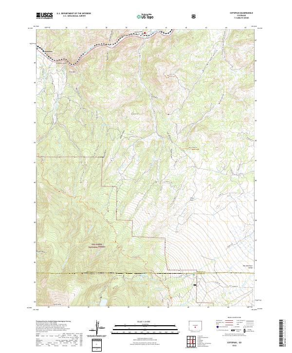
2022 Map of Cotopaxi
USGS Topo · Published 2022About this map
The Arkansas River Canyon carves through the northern edge of this Fremont County landscape, defining a steep transition into the rugged high-country terrain of the San Isabel National Forest. Along the river corridor, the small community of Pleasanton sits near the base of prominent peaks like Gobblers Knob and Pole Mtn. To the south, the terrain rises toward the alpine elevations of Wulsten Baldy and the northern reaches of the Wet Mountain Valley.
Find a feature on this map
71 named features on this map. Tap any name to fly to it.
Don’t see what you’re looking for? This feature index may not catch every label — zoom into the map to look around manually.
Map Details
Editions of this 2022 Cotopaxi Map
This is the sole edition of this map. No revisions or reprints were ever made.
Other maps of this area

1950 · Valley View Hot Springs
USGS Topo · 1:24,000

1954 · Pueblo
USGS Topo · 1:250,000

1957 · Pueblo
USGS Topo · 1:250,000

1958 · Pueblo
USGS Topo · 1:250,000

1958 · Beckwith Mountain
USGS Topo · 1:24,000

1959 · Electric Peak
USGS Topo · 1:62,500

1959 · Howard
USGS Topo · 1:62,500

1959 · Cotopaxi
USGS Topo · 1:62,500

1962 · Pueblo
USGS Topo · 1:250,000

1966 · Pueblo
USGS Topo · 1:250,000