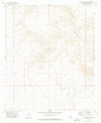
1973 Map of Cotton Center SE
USGS Topo · Published 1976About this map
The Maricopa Mountains dominate this arid landscape, a region defined by high peaks and strategic desert water sources in the 1970s. The topographic detail reveals a network of rugged terrain where the Sheep Mountain summit rises above the northern reaches. For those interested in western transportation history, the southern portion of the quadrangle traces the path of the Butterfield Stage Route, showing how this mid-19th-century overland mail corridor navigated the desert floor between mountain passes.
Find a feature on this map
9 named features on this map. Tap any name to fly to it.
Don’t see what you’re looking for? This feature index may not catch every label — zoom into the map to look around manually.
Map Details
Editions of this 1973 Cotton Center SE Map
This is the sole edition of this map. No revisions or reprints were ever made.
Other maps of this area

1951 · Estrella
USGS Topo · 1:62,500

1951 · Gila Bend
USGS Topo · 1:62,500

1951 · Mobile
USGS Topo · 1:62,500

1951 · Cotton Center
USGS Topo · 1:62,500

1953 · Ajo
USGS Topo · 1:250,000

1954 · Phoenix
USGS Topo · 1:250,000

1957 · Ajo
USGS Topo · 1:250,000

1957 · Phoenix
USGS Topo · 1:250,000

1958 · Ajo
USGS Topo · 1:250,000

1958 · Phoenix
USGS Topo · 1:250,000