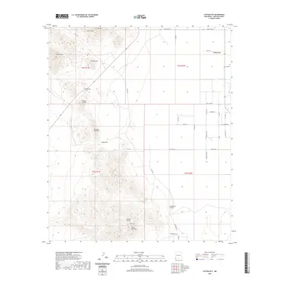
2020 Map of Cotton City
USGS Topo · Published 2020About this map
Cotton City stands as the primary settlement in this southwestern corner of Hidalgo County, situated on a grid of rural roads like Wright Rd and Church Rd. The topography is dominated by the Peloncillo Mountains, where several prominent peaks including Granite Gap Mtn, Preacher Mtn, and Blue Mtn define the high ground. This area serves as a critical passage through the desert terrain, evidenced by the presence of Granite Gap and Cowboy Pass. A network of canyons and drainages, such as Wood Canyon and Weatherby Canyon, suggests the seasonal water flow patterns typical of the region. The map reveals a transition from the structured township and range sections of the eastern flats into the more complex, higher elevations of Eagle Nest Peak and 1117 Mtn to the south.
Find a feature on this map
39 named features on this map. Tap any name to fly to it.
Don’t see what you’re looking for? This feature index may not catch every label — zoom into the map to look around manually.
Map Details
Editions of this 2020 Cotton City Map
This is the sole edition of this map. No revisions or reprints were ever made.
Other maps of this area

1917 · San Simon
USGS Topo · 1:125,000

1917 · Chiricahua
USGS Topo · 1:125,000

1918 · Pratt
USGS Topo · 1:62,500

1919 · Pratt
USGS Topo · 1:62,500

1919 · Chiricahua
USGS Topo · 1:125,000

1926 · Rodeo
USGS Topo · 1:62,500

1928 · Chenoweth
USGS Topo · 1:62,500

1950 · Vanar
USGS Topo · 1:62,500

1951 · Vanar
USGS Topo · 1:62,500

1954 · Silver City
USGS Topo · 1:250,000